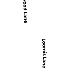
29-B LOOMIS LN
Owner Information
ANDERSON MARK&BUDRYK JENNIFER
PO BOX 1432
E ORLEANS, MA 02643


Property Details
29-B LOOMIS LN is classified as a Undevelopable Residential Land.
29-B LOOMIS LN is valued at $66,900. The land is valued at $66,900 and the structures are valued at $0.
This property is in Zone R. Confirm with local Zoning Board authorities to ensure there are no overlays or other easements on this property.
The most recent deed for 29-B LOOMIS LN is recorded at the local registrar in Book 17856, Page 284. 29-B LOOMIS LN was last sold on Wednesday, October 29, 2003 for $1.
Assessment data from fiscal year 2022.
Flood Data
This property is completely within the AE Zone (within floodplain).
The base flood elevation for this flood zone is 13 feet.
This information is sourced from the FEMA National Flood Hazard Layer. See our full disclamer.
Broadband Internet Providers
| Provider | Type | Bandwidth (mbps) | |
|---|---|---|---|
| HughesNet | Satellite | 25 | 3 |
| GCI Communication Corp. | Satellite | 0 | 0 |
| Comcast | Cable | 1000 | 35 |
| Viasat Inc | Satellite | 35 | 3 |
| VSAT Systems, LLC. | Satellite | 2 | 1 |
| Verizon New England Inc. | DSL | 7 | 0 |
Broadband service provider data from December 2020.
Adjacent Properties
- 197-B MAIN ST
Single Family Residential owned by ALEKNA CATHERINE - 37 LOOMIS LN
Vacant, Conservation Organizations (Charitable Org.) owned by ORLEANS CONSERVATION TRUST - 22 MANITO WY
Single Family Residential owned by GUZZEAU GARY J & GWYNNE W - 29 LOOMIS LN
Single Family Residential owned by ANDERSON MARK& BUDRYK JENNIFER